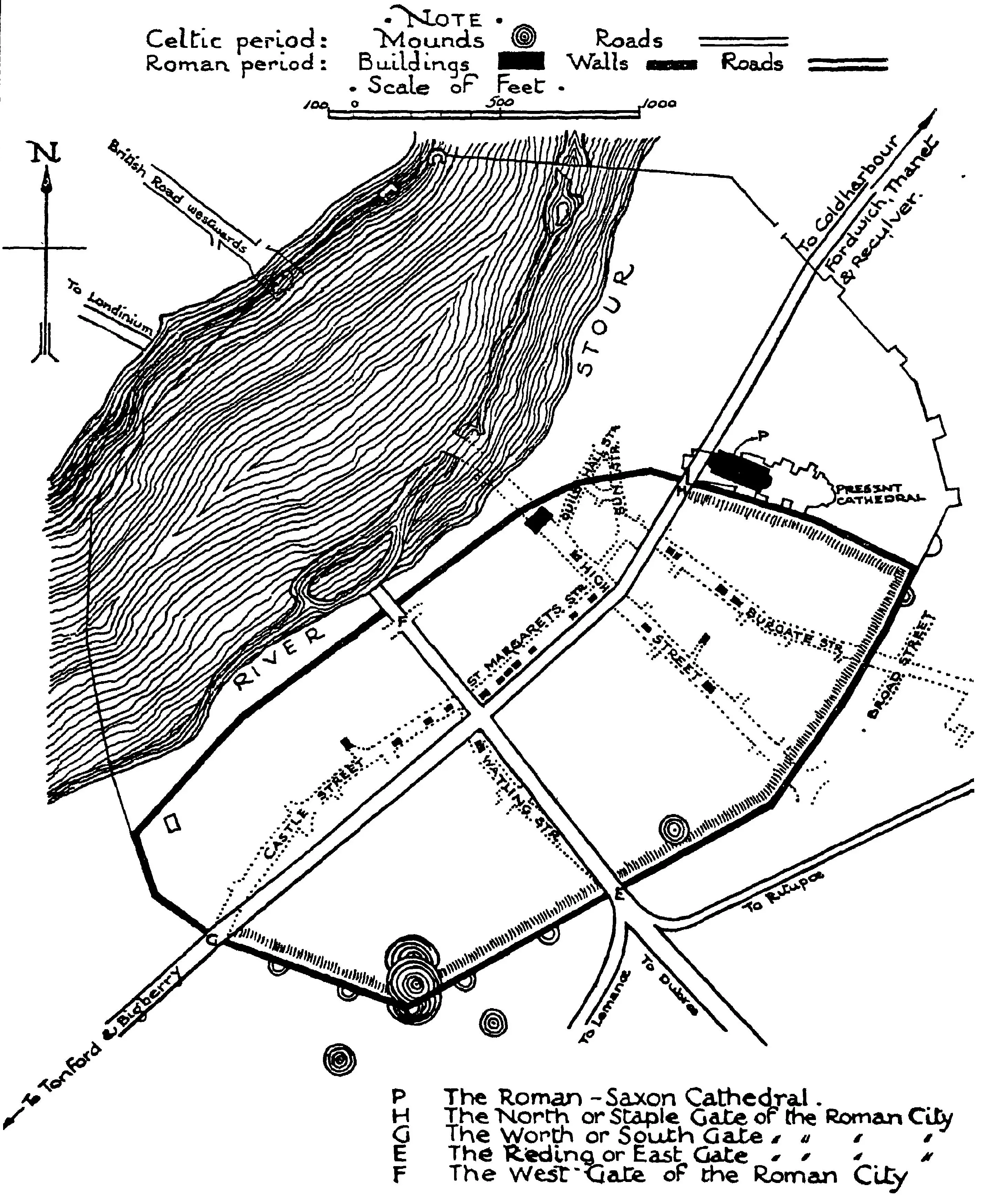
Plan of Durovernum (Canterbury) in Roman Times: A Strategic Crossing and Hub of Commerce
Plan of Durovernum
Roman history imageThis detailed image reconstructs Dungeon Hill and the surrounding area of Durovernum (present-day Canterbury) during Roman times. Envisioned based on historical texts and archaeological insights, the scene highlights the strategic importance of this location, where the Kentish Stour River divides into multiple branches, creating a vital ford. The fortified hilltop features Roman structures such as a stone watchtower and fortifications, surrounded by a Roman-style wall. The landscape includes a Roman road leading to the hill, with soldiers and citizens in Roman attire going about their daily activities. Lush greenery and the river valley provide a scenic backdrop. The depiction reflects the grandeur and organization of Roman engineering, with clear skies and soft lighting enhancing the historical ambiance. This visualization emphasizes Dungeon Hill’s role as a key military and commercial hub, where major Roman roads converged, facilitating trade and movement in the region.
Cotton, Charles. The Saxon Cathedral at Canterbury and the Saxon Saints Buried Therein. Manchester: Manchester University Press, 1929.