Fold-out plan of Norman Canterbury from Godfrey-Faussett’s 1875 paper, showing the westward extension of the city walls, Canterbury Castle, Archbishop Lanfranc’s palace, and other Norman additions. A nineteenth-century antiquarian reconstruction.
Canterbury III. Norman
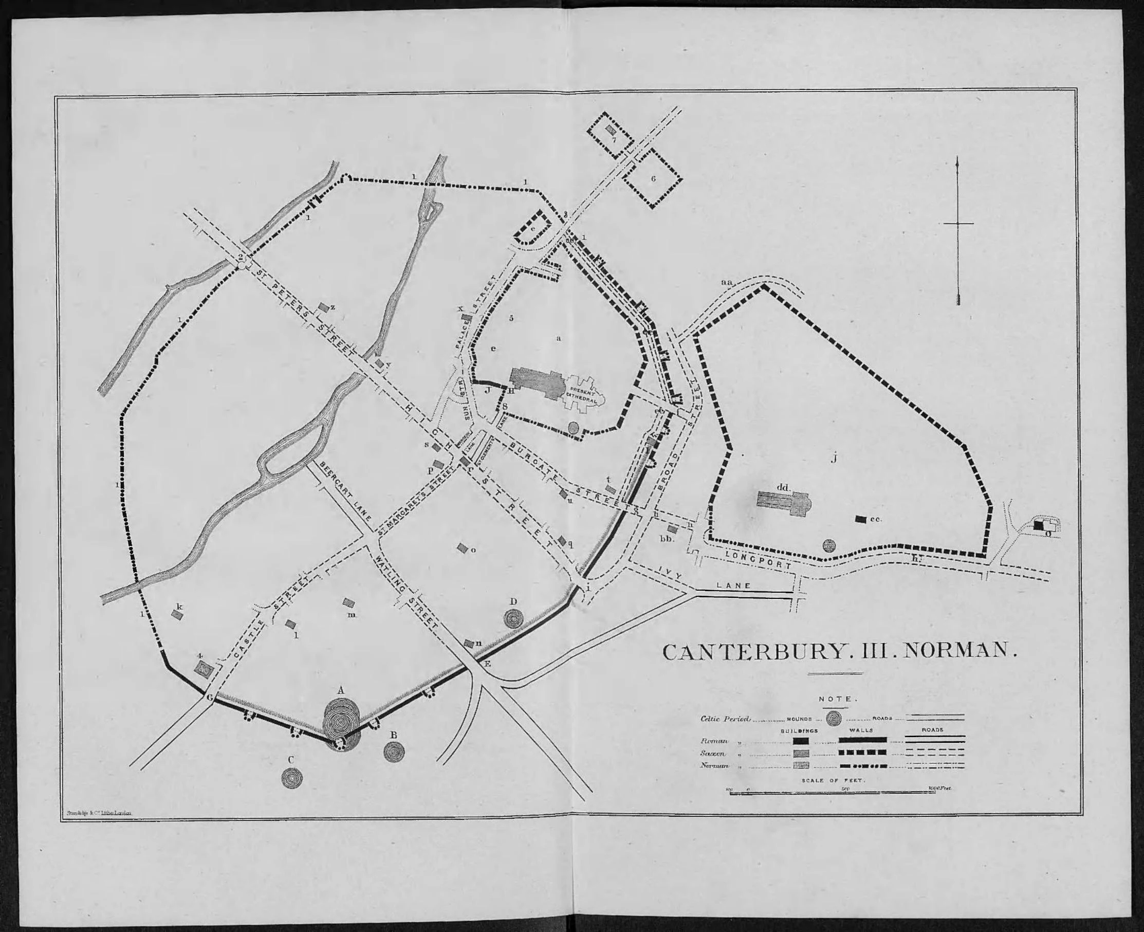
Godfrey-Faussett Norman period image mapThis plan of Canterbury in the Norman period accompanies T. G. Godfrey-Faussett’s 1875 paper “Canterbury Till Domesday.” It represents a nineteenth-century antiquarian reconstruction of the changes brought by the Conquest and the building programs of Archbishop Lanfranc.
Reading the Map
New Norman features include: 1.1.1 (extended city wall westward); 2 (Westgate); 3 (Northgate, rebuilt on Lanfranc’s new road line); 4 (Canterbury Castle); 5 (Archbishop’s Palace, built by Lanfranc after diverting the old Roman road into what became Palace Street); 6 (Priory of St. Gregory); 7 (Hospital of St. John); 8 (Christ Church Priory Gateway).
The Dane John Mound in the Norman Period
The Dane John mound is visible in the southeastern portion of the plan within the city walls. The Normans adapted it as a motte-and-bailey castle shortly after the Conquest of 1066, but this use was brief. Historic England indicates the military life of the castle probably ended when the stone castle to the west was built, a process completed in the early twelfth century, after the Domesday survey of 1086 that provides this map’s chronological endpoint. The mound as shown on this map was therefore still in active Norman military use.
Source
Godfrey-Faussett, T. G. “Canterbury Till Domesday.” Archaeological Journal 32, no. 1 (1875): 369-393. Public domain.