Fold-out plan of Saxon Canterbury (Cantwarabyrig) from Godfrey-Faussett’s 1875 paper, showing the northward extension of the Roman city, Ethelbert’s palace, the Saxon churches, and St. Augustine’s Abbey. A nineteenth-century antiquarian reconstruction.
Canterbury II. Saxon (Cantwarabyrig)
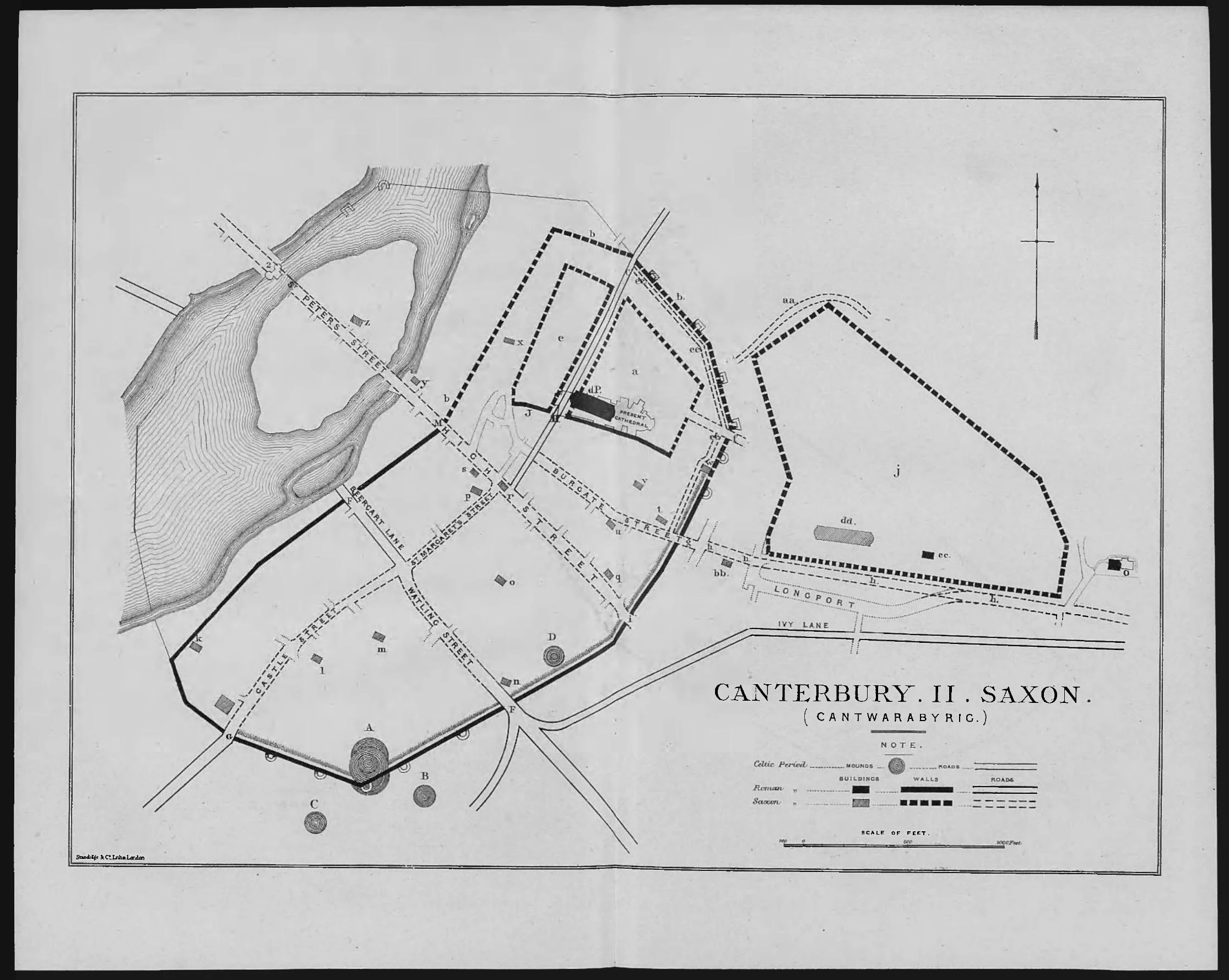
Cantwarabyrig Godfrey-Faussett Saxon period image mapThis plan of Canterbury in the Anglo-Saxon period accompanies T. G. Godfrey-Faussett’s 1875 paper “Canterbury Till Domesday.” It represents a nineteenth-century antiquarian reconstruction showing how the Saxon city Cantwarabyrig developed from the Roman foundations.
Reading the Map
New Saxon features added to the Roman plan include: a (Ethelbert’s Palace, given to Augustine, site of Christ Church monastery); b.b.b (extended city wall northward); c (the Saxon Staple Gate); e (the land of Staplegate, Augustine’s first Canterbury home); f (Queningate); g (Burgate); j (St. Augustine’s Abbey, outside the walls to the east). The map also shows the Saxon churches and market places outside the gates.
A Note on the Dungeon Area
The Dane John mound itself stood within the Roman and Saxon city walls. The later manor house, per Hasted’s account, stood just outside the city walls to the west of the mound. The broader manorial estate therefore adjoined the mound rather than occupying the mound itself. In this period, the land south of the walls was likely common ground or agricultural land rather than any formal settlement.
Source
Godfrey-Faussett, T. G. “Canterbury Till Domesday.” Archaeological Journal 32, no. 1 (1875): 369-393. Public domain.