Roman Origins of the Dungeon
Roman Remains and the Later Earthwork
The Roman history of Dane John requires a distinction between the city walls and the mound beside them. They occupy the same landscape, but that does not make them parts of a single defensive work. Historic England’s scheduled-monument account records a Roman bank inside the city wall and a probable Roman burial mound beneath the later Norman motte. The first is evidence of town defences; the second is an interpretation of the mound’s earlier purpose.
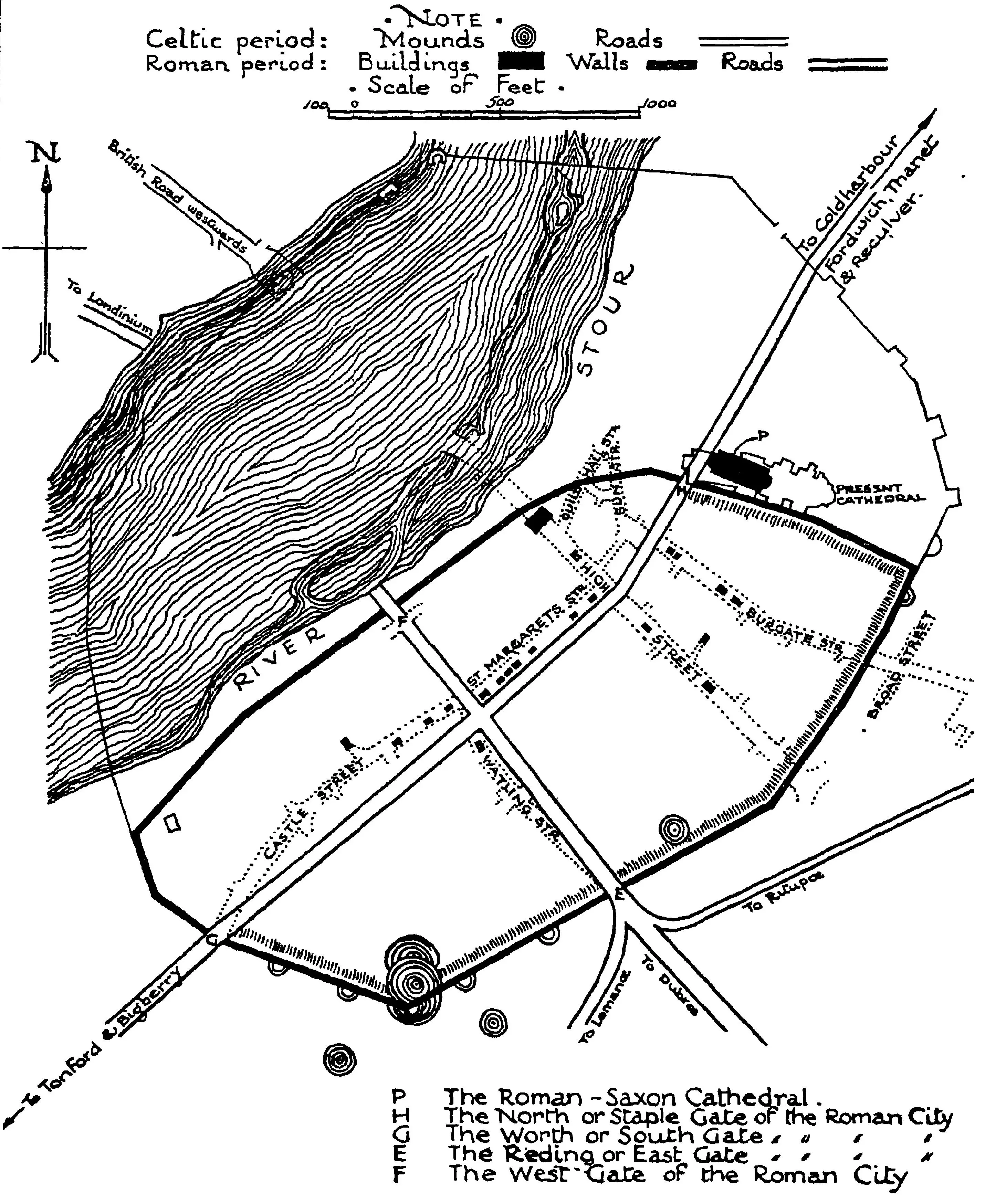
The Walls and the Mound
Roman Canterbury was known as Durovernum Cantiacorum. The historical plan in the archive helps orient the reader, but a reconstructed plan is not an excavation record. The physical evidence has to carry the argument about what happened at this particular site.
The scheduled-monument description places the mound against the inner edge of the city wall and identifies its likely Roman core as part of a burial group. It does not identify the mound as a Roman military lookout. A bank associated with the wall and a nearby burial mound could have different functions, even if a later fortification made use of both.
A Probable Burial Mound, Not a Settled Prehistoric Date
The account of the ancient mounds sets out the evidence for the group and the uncertainty about earlier activity. Kent’s Historic Environment Record places the reported Bronze Age axe in companion mound B, not in the surviving principal mound A. That find cannot by itself date the surviving mound to the Bronze Age.
The distinction is straightforward but important. An old object found in one mound does not establish when another mound was built. Nor does evidence that an earthwork preceded a wall establish that it preceded the entire Roman town. The qualified Roman-burial interpretation is therefore retained, rather than turning possible earlier origins into an established chronology.
After Roman Canterbury
The sources cited here do not demonstrate Anglo-Saxon military reuse of the mound. That is a gap in the evidence, not proof that it stood unused. The Anglo-Saxon chapter considers the wider city’s history; it should not be used to supply an otherwise unrecorded function for this earthwork.
The later Norman fortification has a more specific archaeological basis. The Norman chapter now explains the ditch excavated in 1981 and the interpretation of it as part of the castle’s bailey. Subsequent landscaping also changed the mound. The shape visible today is not an unchanged Roman design.
The November 2026 research note records the removal of this page’s earlier unsupported military-use claims. The route and archival plan have been retained.